


National Weather Service issues winter storm watch Jan. 24-25; bitter cold temps for the weekend
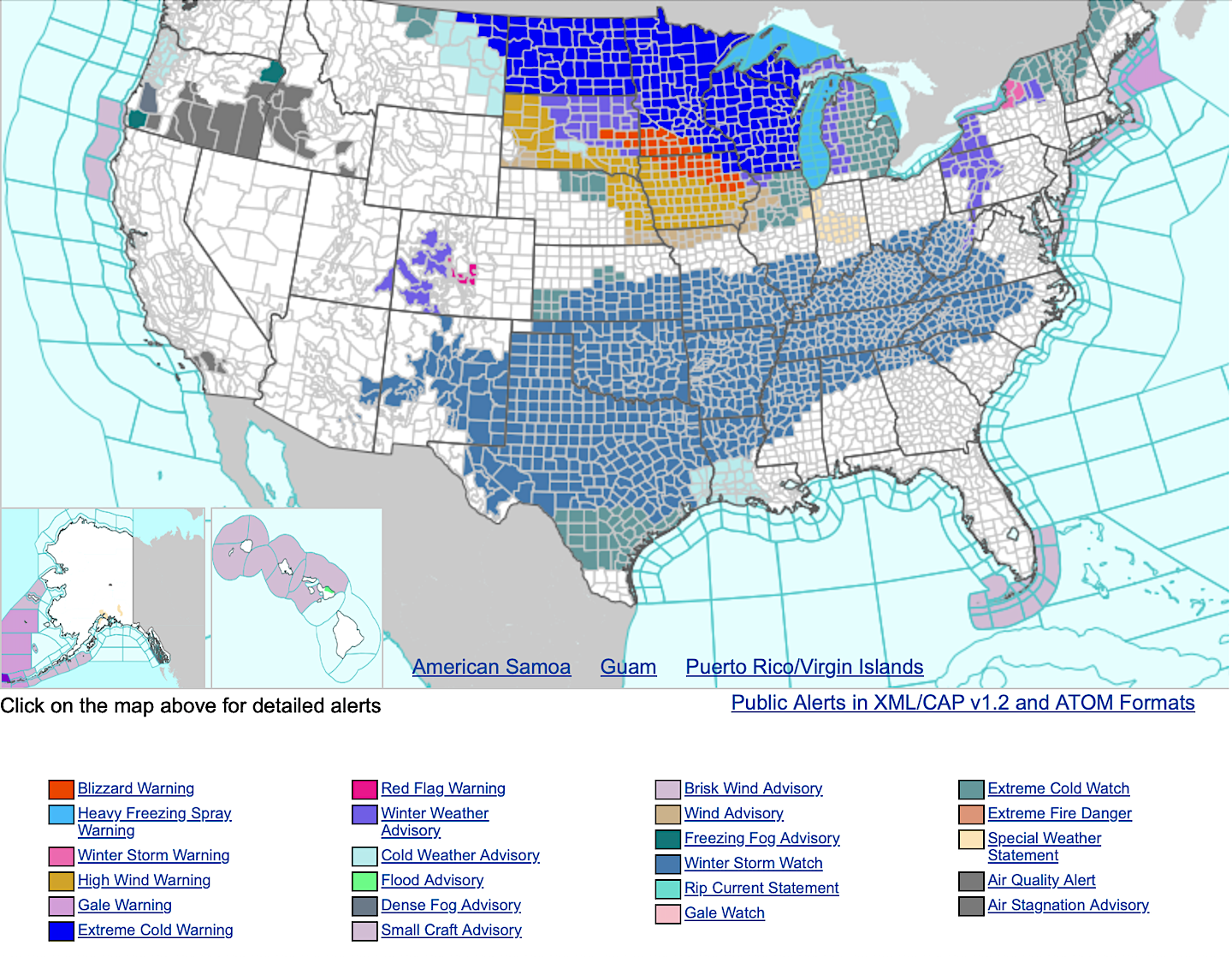
The National Weather Service has issued a winter storm watch from Saturday morning (Jan. 24) through late Sunday night for Highland and surrounding counties.
Heavy snow with total accumulations between 4 and 6 inches is possible.
Portions of southeast Indiana, northeast and northern Kentucky, and south central and southwest Ohio are included in the advisory.
Travel could be very difficult. Persons should consider altering their travel plans. If you do plan to travel in hazardous winter conditions, consider taking a winter storm kit along with you, including such items as tire chains, booster cables, flashlight, shovel, blankets and extra clothing. Also take water, a first aid kit, and anything else that would help you survive in case you become stranded.
Forecast
Thursday – Mostly sunny, with a high near 33. West wind 8 to 10 mph, with gusts as high as 22 mph.
Thursday Night – Mostly cloudy, with a low around 17. West wind 3 to 6 mph.
Friday – Mostly cloudy, with a high near 22. Northwest wind 8 to 10 mph.
Friday Night – Mostly cloudy, with a low around 5.
Saturday – Snow likely after 1pm. Cloudy, with a high near 14. Chance of precipitation is 60%.
Saturday Night – Snow. The snow could be heavy at times. Low around 11. Chance of precipitation is 90%.
Sunday – Snow likely, mainly before 1pm. Cloudy, with a high near 21. Chance of precipitation is 70%.
Sunday Night – A chance of snow before 1am. Mostly cloudy, with a low around 4. Chance of precipitation is 30%.
Monday – Mostly cloudy, with a high near 15.
Monday Night – Partly cloudy, with a low around -1.
Tuesday – Sunny, with a high near 19.
Tuesday Night – Mostly cloudy, with a low around 10.
Wednesday – Mostly cloudy, with a high near 25.